Your Cart is Empty
Le Epic Mountain Bike Ride de 2011

Well it’s that time of year again…time for our self-proclaimed “Le Epic Mountain Bike Ride”. It’s the traditional end of summer ritual, a time when the aspens are turning (although they aren’t quite there this year…) and when chances of snow are much greater than chances of a thunderstorm (both of which are common in the Rockies this time of year).
What makes this ride so “epic” you ask? Well I'll tell ya…It’s epic because it includes roughly 4,448 feet of elevation gain, and 4,978 feet of loss over 30 of some of the most amazing Colorado single track miles. It’s at that time of year when the air has become crisp, the tundra is turning that burnt orange color, and when the peaks have their first dusting of snow.
Le Epic Mountain Bike Ridemust always start with a bagel breakfast sandwich at the famous Pika Bagel Bagelry in Frisco, Colorado. (I finished mine off with a hot chocolate with whip cream on top, just cause I like calories and I’ll take ‘em wherever I can get them).
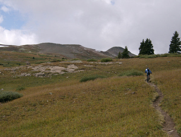
The ride starts in earnest at Copper Mountain, in the base village. Every year it seems we have problems finding the actual start of the ride, as it begins on the Colorado trail where it spurs off one of Copper’s service roads that traverse the mountain. Well this year we weren’t having any of that up and down weaving all over trying to find the trail…we knew it starts just west of Copper’s West Ten Mile run, so we just hike-a-biked straight up the run and found it at about tower 9 of “L” lift.
A quick downhill and we were soon ascending the valley through which Guller Creek drains. From here on up it’s classic singletrack, and 7 miles later we were passing through Searle Pass at 12,035. For the next 3 miles (till Kokomo pass) the ride is all above timberline, and the views were stunning as always. Two nights prior to our trip the peaks got a nice dusting of snow at about 12,500. Today the weather kept swirling in and out with sunbreaks (that’s what the call them in Oregon!), grauple, then misty clouds.
After passing through Kokomo Pass (12,011’) at 10 miles, it’s a roaring 3000’ feet decent into the famed Camp Hale. (Camp Hale was established in 1942 to provide winter and mountain warfare training during World War II.) Killer views of the rugged Elk Range here.
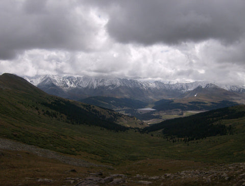
 Saving the best for last, we began the torturous ascent up Ptarmigan pass (11,772’) from the valley floor (9,200’), which took about an hour and a half. I have no idea how steep this road is, but the latter half we were in our lowest gears - it was a GRIND. It’s a painfully awesome climb, making the views from the top all worth it.
After a short recovery/celebration, we then descended more single track through Wilder Gulch, a boggy, willow-packed valley that leaves you nervous looking around every bend in the trail for large animals. It's a beautiful drainage, with lots of beaver ponds and a few old mine tailing piles.
Soon enough, the previous 5 hours of isolation was rudely interrupted by the sight and sound of I-70 as it came into view. This is both a welcoming, and disconcerting sight; I was bummed the ride was over and we were back to civilization, but at the same time my butt was kicked and once we popped out on top of Vail Pass (10,617'), it was an easy cruise down the bike path to Copper.
This is one of my favorite rides in Colorado; best times are early July, once the snow melts up high, to early October, when the snow begins to fly again.
The Epic Mountain Bike Ride of 2011 was a success, and we can’t wait for next year!
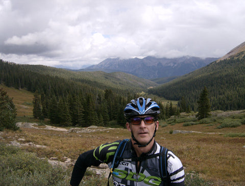
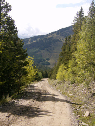
Guller Creek valley and Tenmile Range behind me
Mosquito Range with 1st snow of the season
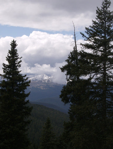
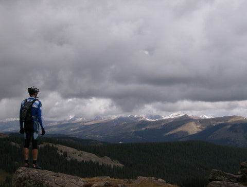
Elk Range
The ascent up Ptarmigan Pass. You can barely make out Mt. Holy Cross in the upper left photo.
Leave a comment
Comments will be approved before showing up.
Free Athletic Stuff
-
Free Water Bottle With Purchase Of $100

Simply Add To Cart & Use Coupon Code: FREEBOTTLE
Free Visor With Purchase Of $150

Simply Add To Cart & Use Coupon Code: FREEVISOR
{"statementLink":"","footerHtml":"","hideMobile":false,"hideTrigger":false,"disableBgProcess":false,"language":"en","position":"left","leadColor":"#146ff8","triggerColor":"#146ff8","triggerRadius":"50%","triggerPositionX":"right","triggerPositionY":"bottom","triggerIcon":"wheels","triggerSize":"medium","triggerOffsetX":20,"triggerOffsetY":20,"mobile":{"triggerSize":"small","triggerPositionX":"right","triggerPositionY":"bottom","triggerOffsetX":10,"triggerOffsetY":10,"triggerRadius":"50%"}}